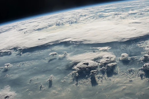
Weather front
Boundary between differing air masses, often causing weather changes.

A weather front is a boundary separating air masses for which several characteristics differ, such as air density, wind, temperature, and humidity. Disturbed and unstable weather often arises along the boundary, with cold fronts bringing thunderstorms and warm fronts bringing stratiform precipitation and fog. Fronts are key features in surface weather analysis and are classified by type—cold, warm, occluded, stationary—each with distinct symbols on weather maps.
- types
- cold, warm, occluded, stationary, shear line
- associated_phenomena
- thunderstorms, squall lines, stratiform precipitation, fog, dry lines
- movement
- cold fronts generally west to east; warm fronts poleward; occluded fronts hybrid; stationary fronts stalled
- symbols_on_maps
- blue line with triangles (cold), red line with semicircles (warm), purple line with alternating half-circles and triangles (occluded), alternating red half-circles and blue spikes (stationary)
- classification_system
- Bergeron classification (three letters: moisture, thermal, stability)
- key_terms
- anafront (unstable, heavy precipitation), katafront (weaker, limited rainfall), trowal (projection of warm air aloft in occlusion)
Lore & Background
Weather fronts are boundaries where air masses of different density, temperature, and humidity meet. Cold fronts move faster than warm fronts because dense cold air lifts and pushes warmer air, often producing narrow bands of thunderstorms. Warm fronts move more slowly, with broader temperature gradients and stratiform clouds ahead. Occluded fronts form when a cold front overtakes a warm front, creating a hybrid boundary with a trowal aloft. Stationary fronts stall, sometimes degenerating into shear lines over open ocean.
Reader's Guide
Weather fronts are fundamental to meteorology, as they organize precipitation, wind shifts, and temperature changes across synoptic scales. Their study enables forecasting of severe weather, such as thunderstorms along cold fronts or prolonged rain near stationary fronts. The Bergeron classification of air masses helps identify the properties of the air masses separated by fronts. Surface weather analysis uses standardized symbols to depict fronts, aiding in real-time weather interpretation. Fronts can degenerate into shear lines when density contrasts diminish, especially over uniformly warm oceans. Understanding front types—anafront versus katafront—refines predictions of instability and rainfall intensity.
Did You Know?
- Cold fronts can move up to twice as fast as warm fronts.
- Dry lines, subtler humidity gradients in summer, can trigger severe weather.
- Occluded fronts are indicated on weather maps by a purple line with alternating half-circles and triangles.
- When a stationary front degenerates, it may become a shear line separating regions of differing wind velocity.
More in Meteorology 25-38
Elsewhere in the Meteorology universe
Spotted an error? Know more?
This is a living reference — every entry is fact-audited, and reader corrections feed straight into our audit queue. Suggest an edit · See this site's audit record